2022 Ward and Representation Review
In September 2022, the Minister for Local Government announced changes to legislation that result in:
- The Office of Shire President being elected by the electors of the district, rather than Council;
- Reduced Councillor numbers based on population
- Introduction of optional preferential voting
At a Special Council Meeting held on 24 October 2022, Council resolved to change the method of electing the Shire President from the election by the council method to the election by the elector’s method as well as to undertake a ward representation review.
At a Special Council Meeting held on 30 January 2023, Council resolved to reduce Councillor numbers to a total of six commencing at the 2023 ordinary local government election. Each Ward would have two Councillors plus the Shire President elected at large.
This proposal has been accepted by the Local Government Advisory Board and Minister and was formally gazetted on 30 June 2023.
This means that following the 2023 ordinary local government election the Council will comprise the Shire President and six Councillors split evenly across the three wards.
Ward Maps
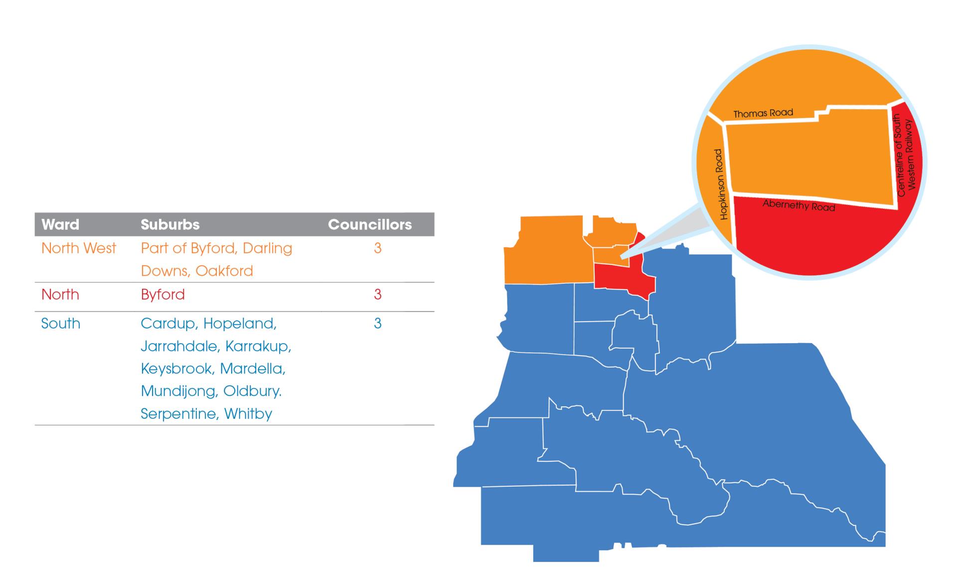
The Shire of Serpentine Jarrahdale is segmented into three areas:
- North ward;
- North West ward; and
- South ward.
Each ward is represented by three councillors. From the 2023 ordinary local government election, each ward will be represented by two Councillors. The wards, their suburbs and the councillor representation are as follows:
For further information on the amendments to our wards that occurred in 2019, please click here.
Ward Map
Boundary Ward Map
North West Ward Map
North Ward Map
South Ward Map
Submissions about changes to names, wards or representation
A submission about changes to wards, names or representation is a formal request made by affected electors. The submission must be in the form prescribed by the Local Government Act 1995 and the Local Government (Constitution) Regulations 1996.
Submission about changes to names, wards or representation - Information and Guidelines
Submission about changes to names, wards or representation Form Template
Online Mapping
You can view the ward boundaries in greater detail by using the Intramaps Online Mapping tool and applying the Ward Boundaries layer.
Online Mapping Tool
Access to the Intramaps Online Mapping Tool.